|  | |
• | Yellow Rock - Description | |
|
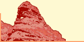
The colorful sandstone and the fantastic view over the Cockscomb area are worth the effort to reach the top of Yellow Rock.
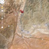
Leaving highway 89 about 27 miles after Page, AZ (direction Kanab, UT) heading north up the Cottonwood Canyon Road (there are signs) for 14.4 miles to the trailhead (and register) for Hackberry Canyon at the left side, some yards after Brigham Plains Road leaves to the right.
Walk down (left) Cottonwood Wash. Cross it after some minutes when a small drainage comes in from the right side. Follow this drainage for some minutes until you see a steep rock fall on the right side, there are cairns to follow. Find the trail up the rock fall.
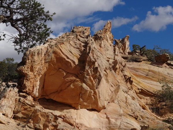
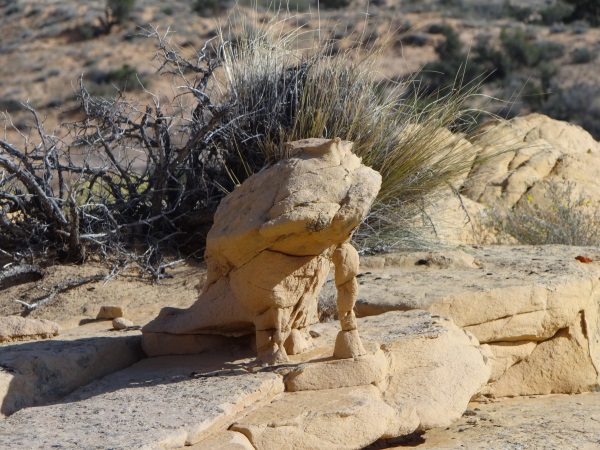
Some minutes behind your climb (depending on your condition) you will see some nice erosional features (see first picture on this page) like pyramids or spikes. You see them on your left side, so - if you are leaving Yellow Rock you will remember where the trail down starts. There are misleading cairns (but there are also speaking frogs - so) don't care, just memorize this erosional feature, you can see it from nearly everywhere on Yellow Rock.
Have a very good weather forecast; we had only a good one, which means first rain drops on our way down the rock fall and for the whole way back out on the Cottonwood Canyon Road a nice rainbow in front of us.
Good hiking shoes for the Cottonwood Wash and the rock fall and a GPS in case of a lousy memory will be helpful. We've been there in mid October and it was really fresh up there.
A perfect dayhike! You should be in a good physical condition. The rock fall is steep and very slippery even at dry conditions; this is not a trail for our kids, not for our grandparents, just too risky.
|
|
|
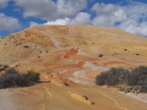
Yellow Rock - Erosion at its best.
|
|
|
|
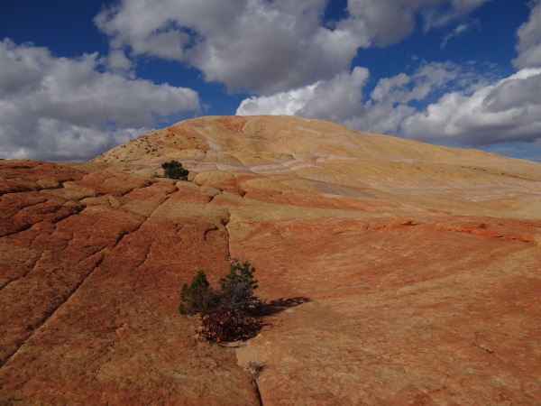
Yellow Rock - Comparable are only the dark clouds.
|
|
|
|
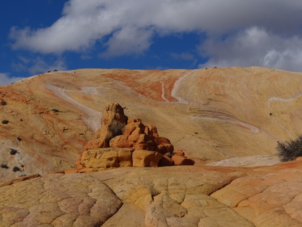
Yellow Rock - Artists Paintpot.
|
|
|
|
Yellow Rock - Kiss me, kiss me - No, you stay here.
|
|
|
|
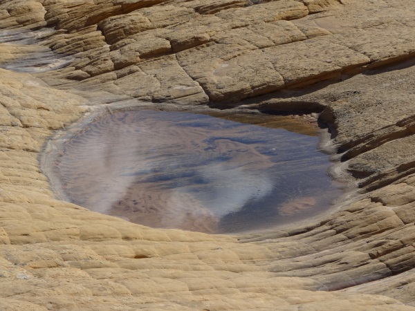
Yellow Rock - First or last waterhole.
|
You will find the map 'Yellow Rock' here.
|
|
| |
• | If you would like to comment on Yellow Rock, give a feedback or for example recommend something - here - please.
| |