|  | |
• | Alstrom Point - Description | |
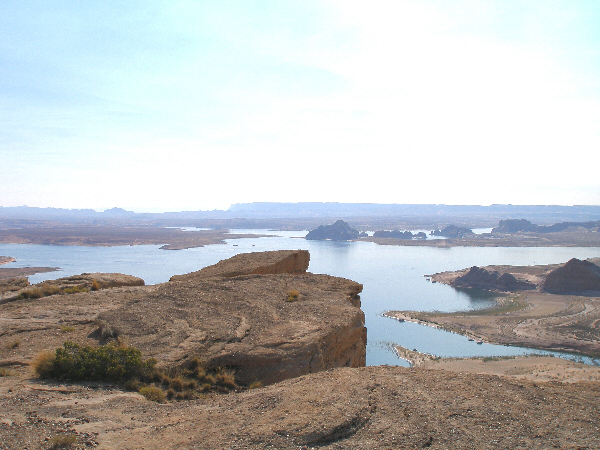
| The Alstrom Point offers spectacular views of Lake Powell. The one way distance from Big Water is around 25 miles.
Driving directions:
Take Hwy 89 to Big Water and turn off north into Ethan Allen. After 0.3 mi turn right onto BLM road 300.
Around 13 mi later the road divides into Smokey Hollow (straight ahead) and Smoky Mountain Road (BLM road 300, to the right). A kiosk describes geological and historical features of the region. Go right in direction Smoky Mountain Road and Grand Bench.
The next branch with a sign is reached after around 1 mi.
Leave the BLM road 300 in direction to Grand Bench (BLM Road 340, also named Croton Road) and follow it for 4.1 mi.
On the top of a hill you have to change the driving direction to the right and follow the BLM road 230. Don't miss it; the wrong road will become more and more adventurous.
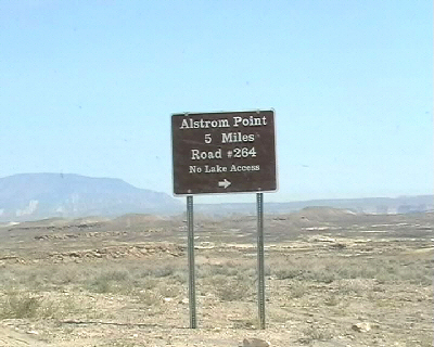
After around 20 mi the sign to Alstrom Point (road 264) shows that your destination is reached in 5 miles to the right. The last two miles are very rough and only passable by 4WD, but you can hike this part easily. We recommend controlling the existence of a spare tire, flashlight and tools; we had to use all these things at a beautiful sun set under our car.
We would not recommend this trip in any kind of wet weather.
|
|
|
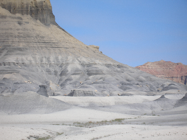
| You may feel on the moon; Smokey Mountain view on the way to Alstrom Point.
(The burning hills and smoky mountains of Kane County get their names from naturally burning of deep underground coal deposits.)
|
|
|
|
|
The sign to Alstrom Point on the Romana Mesa peninsula.
|
|
|
|
|
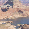
Gunsight Butte at Lake Powell.
|
|
|
|
|
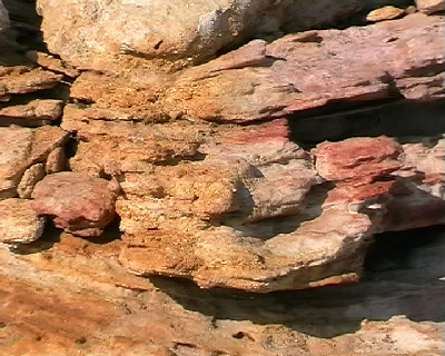
Sandstone rock formation.
|
|
|
|
|
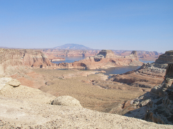
View from Alstrom Point to Castle Rock; high above ground on the cliffs of Romana Mesa.
|
You will find the map 'Alstrom Point' here.
|
|
| |
• | If you would like to comment on Alstrom Point, give a feedback or for example recommend something - here - please.
| |